Talgua Cave Archaeological Park
Return to Talgua
Don Stierman: August,
2001
In May and June of 1996 over 30 scientists and science students, along with
several journalists, work to discover secrets of the Cave of the Glowing Skulls,
the Cueva de las Arañas and a series of prehistoric mounds called Talgua
Village. The Discovery Channel broadcast an abridged version of Dean Love’s
"director’s cut" in September of 2000.
Hurricane Mitch destroyed much of the new archaeological park in late October
of 1998. The park reopened in July of 2001. This report is based on a visit that
took place on August 7 of 2001.
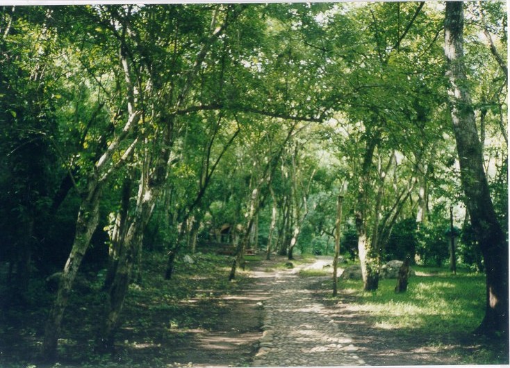
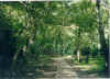
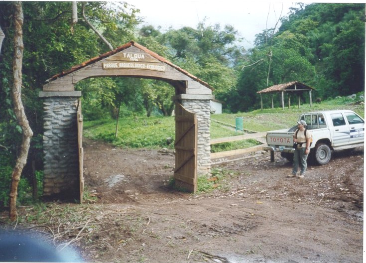
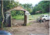 The
road to the park entrance is longer but less challenging that that taken in
1996. We cross the river on concrete pads built to withstand the power of the
usual floods. Any bus or taxi in Catacamas could have reached the park entrance
(left). Mud holes were rare and shallow. A stone path leads from the park gate
to the park facilities: cave entrance, ticket booth, museum, restaurant, and
restrooms.
The
road to the park entrance is longer but less challenging that that taken in
1996. We cross the river on concrete pads built to withstand the power of the
usual floods. Any bus or taxi in Catacamas could have reached the park entrance
(left). Mud holes were rare and shallow. A stone path leads from the park gate
to the park facilities: cave entrance, ticket booth, museum, restaurant, and
restrooms.
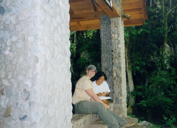
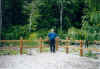
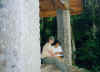 We
have to wait for the cave to open. A recent storm downed a large tree that
blocks the path from the gate to the visitors' center and the park director was
arranging for its removal. Iris, a guide, practices her English with my
graduate student as
I tell her all I know about the science done to discover the ancient secrets of
Talgua Cave and its neighborhood. Students from a local school arrived
shortly after this photograph was taken, the cave opened and Iris went right to
work.
We
have to wait for the cave to open. A recent storm downed a large tree that
blocks the path from the gate to the visitors' center and the park director was
arranging for its removal. Iris, a guide, practices her English with my
graduate student as
I tell her all I know about the science done to discover the ancient secrets of
Talgua Cave and its neighborhood. Students from a local school arrived
shortly after this photograph was taken, the cave opened and Iris went right to
work.
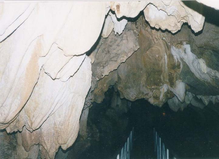
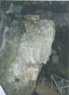 A
boardwalk (left) takes us past an iron gate (locked when the cave is closed)
above the flowing water and deep into the heart of the mountain. There is plenty
of room for even this stout gringo but watch your head, even our guide has to
duck under some stone ledges and stalactites. We are greeted by several large
bats – they are probably more frightened of us than we are of them. A
generator provides power for lights strung through the cave, mostly positioned
to illuminate flowstone and other features as calcite accumulates on floor,
ceiling and walls of the cave. All too soon we reach a second (locked) gate at
the top of some stairs. Through the bars we can see the bottom of the ladder
extending up to the famous burial chambers. Sorry, that part of the cave is not
open to tourists. Entrance to the cave costs $5 for foreign visitors plus
a tip (Lps. 5 per person is the suggested tip) for the guide. It takes
money to put gasoline into that generator, and there is still a lot of work to
do in the museum.
A
boardwalk (left) takes us past an iron gate (locked when the cave is closed)
above the flowing water and deep into the heart of the mountain. There is plenty
of room for even this stout gringo but watch your head, even our guide has to
duck under some stone ledges and stalactites. We are greeted by several large
bats – they are probably more frightened of us than we are of them. A
generator provides power for lights strung through the cave, mostly positioned
to illuminate flowstone and other features as calcite accumulates on floor,
ceiling and walls of the cave. All too soon we reach a second (locked) gate at
the top of some stairs. Through the bars we can see the bottom of the ladder
extending up to the famous burial chambers. Sorry, that part of the cave is not
open to tourists. Entrance to the cave costs $5 for foreign visitors plus
a tip (Lps. 5 per person is the suggested tip) for the guide. It takes
money to put gasoline into that generator, and there is still a lot of work to
do in the museum.
 The
cave seems smaller now that there are lights and a boardwalk that it did 5 years
ago, when we navigated this passage up to our knees in water, carrying
flashlights. The hike is not as taxing but the cave is no longer as mysterious.
Tourists today may not appreciate the effort made almost 3000 years ago by
people who carried bones and gifts up this passage with only torches for light
before climbing to the burial chamber without using a modern ladder. We do not
see the bats as we walk back to the entrance. They are probably hiding in one of
the many side passages or high overhead, out of sight above the lights.
The
cave seems smaller now that there are lights and a boardwalk that it did 5 years
ago, when we navigated this passage up to our knees in water, carrying
flashlights. The hike is not as taxing but the cave is no longer as mysterious.
Tourists today may not appreciate the effort made almost 3000 years ago by
people who carried bones and gifts up this passage with only torches for light
before climbing to the burial chamber without using a modern ladder. We do not
see the bats as we walk back to the entrance. They are probably hiding in one of
the many side passages or high overhead, out of sight above the lights.
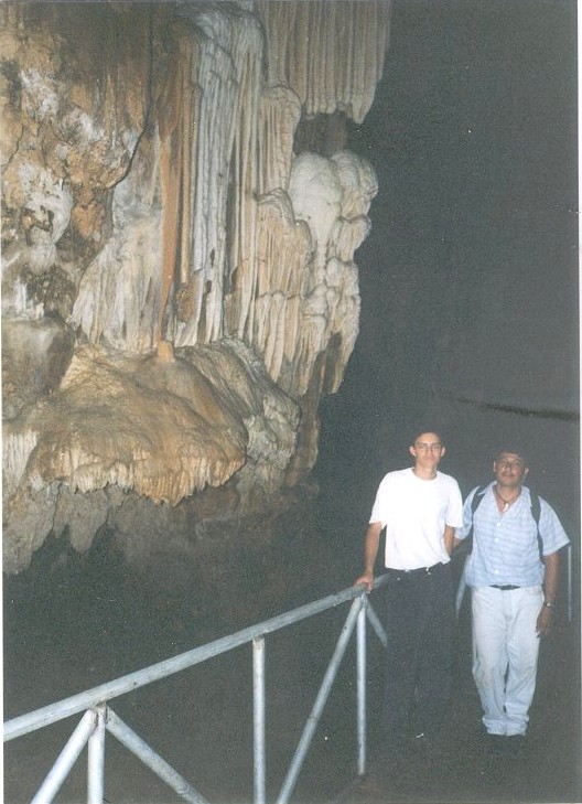
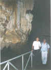 Our
bilingual guide (white shirt) poses with Santiago under a spectacular flowstone
formation.
Our
bilingual guide (white shirt) poses with Santiago under a spectacular flowstone
formation.
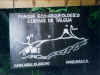
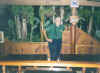
 Museum
displays of cave burials are replicas – preserving the "real thing"
probably requires climate control. The ‘statue’ found during the Talgua
Village dig is on display in the museum, but someone has marked the face with
chalk. It looks sad and in need of a good cleaning. Posters with images from
research reports hang on the museum walls, and pottery representative of the
prehistory of Honduras is nicely and efficiently displayed.
Museum
displays of cave burials are replicas – preserving the "real thing"
probably requires climate control. The ‘statue’ found during the Talgua
Village dig is on display in the museum, but someone has marked the face with
chalk. It looks sad and in need of a good cleaning. Posters with images from
research reports hang on the museum walls, and pottery representative of the
prehistory of Honduras is nicely and efficiently displayed.
 This
path leads from the museum back toward the visitors' center and cave entrance.
This
path leads from the museum back toward the visitors' center and cave entrance.
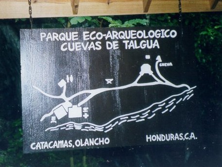
 This
map shows the visitors' center next to the cave entrance. Restrooms, the
museum and comedor are just a short walk to the north (left on this map).
This
map shows the visitors' center next to the cave entrance. Restrooms, the
museum and comedor are just a short walk to the north (left on this map).
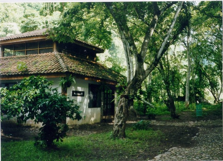
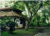
 The
comedor is not yet running at capacity, probably because customers are
few and far between. There is ice (made from purified water, of course) for our
soft drinks. A terrace overlooks the river and a rain forest covers most of the
opposite bank (left). Cultivated fields expose the steep terrain to our left as
we look across the Río Talgua – this diverse environment should
attract a wide variety of birds and butterflies. I hear more birds than I can
see. This park is a very peaceful retreat. The only sounds are occasional
birdcalls against a background of water rushing over rocks. Light sprinkles fall
from some of the clouds passing overhead. These are small morning drops; really
heavy rains are usually confined to afternoons and evenings. Most of the morning
showers are intercepted by broad rain forest leaves and never tough the ground.
The
comedor is not yet running at capacity, probably because customers are
few and far between. There is ice (made from purified water, of course) for our
soft drinks. A terrace overlooks the river and a rain forest covers most of the
opposite bank (left). Cultivated fields expose the steep terrain to our left as
we look across the Río Talgua – this diverse environment should
attract a wide variety of birds and butterflies. I hear more birds than I can
see. This park is a very peaceful retreat. The only sounds are occasional
birdcalls against a background of water rushing over rocks. Light sprinkles fall
from some of the clouds passing overhead. These are small morning drops; really
heavy rains are usually confined to afternoons and evenings. Most of the morning
showers are intercepted by broad rain forest leaves and never tough the ground.
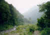 Water
is this stretch of the Río Talgua is clear and cool, but probably not
pure enough to drink untreated. We saw some tourists cooling their feet in the
river after visiting the cave. A few hundred meters upstream the canyon divides;
Quebrada El Penabetal to the east (right) and Río Talgua to the
west (left). A short walk up Río Talgua brings us to the river’s
source – an enormous spring flowing from the base of the hill. We cannot
investigate this spring in detail, it is fenced off, no doubt to protect water
collection structures feeding the three pipes (see photo) that carry water from
this relatively uncontaminated source down the canyon to supply residents of the
Catacamas valley. Still further upstream the riverbed is dry (well, damp). This
is Río Seco, or Dry River. Rain falling in this watershed either drains
quickly from steep impermeable slopes or infiltrates an extensive karst system
where it is carried underground to discharge points such as the spring we just
passed.
Water
is this stretch of the Río Talgua is clear and cool, but probably not
pure enough to drink untreated. We saw some tourists cooling their feet in the
river after visiting the cave. A few hundred meters upstream the canyon divides;
Quebrada El Penabetal to the east (right) and Río Talgua to the
west (left). A short walk up Río Talgua brings us to the river’s
source – an enormous spring flowing from the base of the hill. We cannot
investigate this spring in detail, it is fenced off, no doubt to protect water
collection structures feeding the three pipes (see photo) that carry water from
this relatively uncontaminated source down the canyon to supply residents of the
Catacamas valley. Still further upstream the riverbed is dry (well, damp). This
is Río Seco, or Dry River. Rain falling in this watershed either drains
quickly from steep impermeable slopes or infiltrates an extensive karst system
where it is carried underground to discharge points such as the spring we just
passed.
Río Seco is a highway into the heart of a rain forest. Paved with
boulders and cobbles, this highway no doubt becomes a violent rapids following
heavy rains. Hurricane Mitch swept the floors of these quebradas clean of
trees and brush almost 3 years ago but few plants have taken root on exposed sand bars, in stark
contrast to the impenetrable jungle rising above us. Rocks over a meter in
diameter have been rounded and polished by abrasion as they are tumbled
downstream during floods. Really large rocks, fallen from cliffs we occasionally
glimpse through the forest canopy, are too massive to move. These room-size
boulders also show effects of abrasion. Nowhere do we see bedrock clearly
exposed – is this a ledge of limestone in place or is it a particularly
coherent slide or fallen block?
-----End of walkabout: later, south of the park:
The road to Talgua Village is the same as in 1996 only less traveled.
Branches hang low over the trail, as few trucks or busses higher or wider than a
Toyota pick-up passed this way recently. Less traffic also mean fewer
water-filled ruts. The road north of the dig looks more like a braided set of
paths made by cows and horses. "Where’s the road?" was the only
comment made by my student, who was certain we were lost.
Grass still covers Talgua Village. Oscar Moya, the landowner, has divided the
site in half with a sturdy barbed wire fence and uses both sections for cattle
grazing. Thorny branches still attack the shoes and legs of those who walk
heedlessly through the knee-high grass. It is difficult to locate evidence of
the dig; minor depressions that mark former excavations might be overlooked by
visitors unfamiliar with their locations.
 Little
appears to have changed at Hotel Juan Carlos. The street remains unpaved and
ditches dug for one or another water or sewer project remain incompletely
filled. The As de Oros has printed new menus, updating prices to keep
pace with the decline of the Lempira with respect to the dollar. Most meals list
for Lps. 110 to 130 ($7 to $9). Testiculo de toro is still on the menu (5
items under that category now) but I though it best to leave that delicacy for
visitors who had not yet experienced it. The dinner was gringo sized, more than
twice the food served elsewhere, so much I didn’t have room to test the
cabbage salad for gastrointestinal microbes.
Little
appears to have changed at Hotel Juan Carlos. The street remains unpaved and
ditches dug for one or another water or sewer project remain incompletely
filled. The As de Oros has printed new menus, updating prices to keep
pace with the decline of the Lempira with respect to the dollar. Most meals list
for Lps. 110 to 130 ($7 to $9). Testiculo de toro is still on the menu (5
items under that category now) but I though it best to leave that delicacy for
visitors who had not yet experienced it. The dinner was gringo sized, more than
twice the food served elsewhere, so much I didn’t have room to test the
cabbage salad for gastrointestinal microbes.
The bus that transported field school students (and the rest of us) – or
its twin – is still operating.
All I know about Larry August’s current activities in the area is what I
read in the newspaper or hear as rumors from other people who read the same
newspapers or supply hearsay to newspaper reporters. They say that Lawrence
August wants to purchase the old military ("contra") air field at El
Aguacate, east of Catacamas, to establish an international airport with
connections to La Mosquitia, Trujillo and the Bay Islands. They say that
he is looking for investors for the airport venture and for construction of a
5-star hotel.
Return in Index
The background image used on this page was borrowed from the Web site of
another famous tropical park.

 The
road to the park entrance is longer but less challenging that that taken in
1996. We cross the river on concrete pads built to withstand the power of the
usual floods. Any bus or taxi in Catacamas could have reached the park entrance
(left). Mud holes were rare and shallow. A stone path leads from the park gate
to the park facilities: cave entrance, ticket booth, museum, restaurant, and
restrooms.
The
road to the park entrance is longer but less challenging that that taken in
1996. We cross the river on concrete pads built to withstand the power of the
usual floods. Any bus or taxi in Catacamas could have reached the park entrance
(left). Mud holes were rare and shallow. A stone path leads from the park gate
to the park facilities: cave entrance, ticket booth, museum, restaurant, and
restrooms.